As
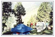
a reflex level, trekking is a physical: a simple desire to pick a path and
measure up to the terrain and the elements. The adventure component add a
the spice of uncertainity, raising stakes for you to test yourself in the
unfamiliar territory.
On a deeper level, trekking is a bridge between ancient lifestyles. As a
evolution from a simple walk into a more self sufficient venture, trekking
requires simplification, a reduction to portable basic, and implicit trust
in your ability to define what you need to live.
Garhwal
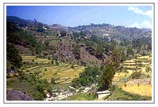
TrekkingThe Garhwal Himalayas are a trekkers delight. The beauty of Garhwal
hills is picture-perfect, a fusion of high mountain valleys and lakes, of
many streams and among India's greatest rivers. Comprising the districts of
Uttarkashi, Tehri-Garhwal, Pauri-Garhwal, Dehra Dun and Chamoli, the Garhwal
hills are a vertible paradise for trekkers.
Some of the Major Trekking Regions In Garhwal
Harkidun, Tons Valley and Ruinsara Tal:
Two days from Delhi to the roadhead at Sankri and two trek days to the
Harkidun where the Pandav brothers are supposed to have ascended the
majestic Swargarohini peak (20,000 ft) on their last leg to Indralok. Known
for its profusion of flowers, its meadows are linked with two routes to
Ruinsara Tal on the edge of the Tons glacier coming off Bandarpunch peak.
Dodi Tal - Darwa Top - Yamunotri (2B):
From Uttarkashi, reach the roadhead at the Kalyani trout hatchery for a 6
km hike to Agora village. A five-hour trek day leads to Dodi Tal, source of
the Asi Ganga Cross Darwa Top (4,115 m) next day and descend to Hanuman
Chatti for the two day trek to Yamunotri (14 km) and further to Saptrishi
Kund (10 km) true source of the Jamuna. Return via Barkot and Mussoorie.
Khatling Glacier Region:
From the roadhead at Ghuttu, reached in two days from Delhi, 2-3 trek days
bring one to the inner recesses of the Bhilangna river which joins the
Bhagirathi near Tehri. The river rises at the snout of the Khatling glacier
and the trails join up with Sahasratal, Masurtal and Vasukital. For those in
good physical trim, the 16-km trek to Kedarnath is recommended.

The
life of a mountain is as intense and varied as a human being and to
experience it one must move around it. In Kumaon mountaineering and trekking
can be done in the regions from where the rivers Pindar, Gori, Dhauli, E.
And Kuti emerge. The peaks and passes near the glaciers of these rivers have
been tempting the mountaineers and the trekkers one of the most enthralling
experience is a trek to the Glaciers of Kumaon.
Some of the Major Trekking Regions In Kumaon
Pindari Glacier Trek (3820 m):
It is one of the most easily accessible of all the Himalayan glaciers.
Pindari's rugged beauty is a breath taking sight. Ahead of Pindari the peaks
of Chhanguj (6,322m) , Nanda Khat (6,611m), Pawali Dwar (6,663m), Nanda
Bhanar (6,236m), Dangkhal (6,050m) and Balijori (5,922m) beckon the
mountaineers.
Kafni Glacier Trek (3,800m):
Many breath taking views of the mighty himalayan ranges are visible from
the trekking route.
Namik glacier (3600m)
10 days trek from the famous birthi fall on the thal munsyari road, the
upper most catchment of the river ramganga east. It is among the more
difficult trekking areas of the higher himalaya and the least trekked region
of kumaon.
Milam glacier (3438m and above)
8 days trek from munsyari. It is the biggest glaciers in the region. Milam
village whichis enroute to the glacier is one of the highest villages in the
himalayan ranges.


 As
a reflex level, trekking is a physical: a simple desire to pick a path and
measure up to the terrain and the elements. The adventure component add a
the spice of uncertainity, raising stakes for you to test yourself in the
unfamiliar territory.
  The
life of a mountain is as intense and varied as a human being and to
experience it one must move around it. In Kumaon mountaineering and trekking
can be done in the regions from where the rivers Pindar, Gori, Dhauli, E.
And Kuti emerge. The peaks and passes near the glaciers of these rivers have
been tempting the mountaineers and the trekkers one of the most enthralling
experience is a trek to the Glaciers of Kumaon.